Thank you for your patience while we retrieve your images.
Taken 25-May-18
Visitors 0


4 of 32 photos
Thumbnails
Info
Categories & Keywords

Category:Scenic
Subcategory:Landscapes
Subcategory Detail:
Keywords:Palouse, The Palouse, United States, Washington, aerial view, agriculture, barley, countryside, crops, cultivated, farming, farmland, fields, geography, green, landscape, lentils, north america, patterns, pea, rolling hills, rural, scenic, spring, topography, wheat
Photo Info

Dimensions5472 x 3648
Original file size10.1 MB
Image typeJPEG
Color spaceAdobe RGB (1998)
Date taken25-May-18 10:47
Date modified3-Sep-26 01:37
Shooting Conditions

Camera makeCanon
Camera modelCanon EOS 7D Mark II
Focal length70 mm
Max lens aperturef/2.8
Exposure1/40 at f/11
FlashNot fired, compulsory mode
Exposure bias0 EV
Exposure modeAuto
Exposure prog.Aperture priority
ISO speedISO 100
Metering modePattern
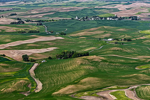
Aerial View of Palouse Farmland

Aerial View of Palouse Farmland

WHITMAN COUNTY, WASHINGTON, UNITED STATES – MAY 25, 2018: Aerial view of agricultural fields, rolling hills, and rural landscapes in the Palouse region. The vibrant green crops and patterned earth create a unique scenic panorama.